Главная » 2012 » Апрель » 12 » Global Mapper 13.0 [Русский, 2011] - 13.1 [English, 2012] x86+x64 + Ключи
17:54 Global Mapper 13.0 [Русский, 2011] - 13.1 [English, 2012] x86+x64 + Ключи | |
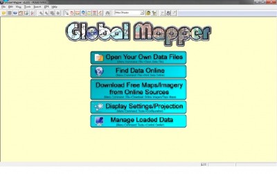 [left]Global Mapper — программа для просмотра, редактирования и конвертации огромного количества картографических форматов, как растровых, так и векторных.[/left] [left]Год: 2012 Размер: 180 Мб Версия: 13.1 и 13.00 Разработчик: Blue Marble Geographics Разрядность: 32bit+64bit Совместимость с Vista: полная Совместимость с Windows 7: полная Язык интерфейса: Английский + Русский Таблэтка: Присутствует Системные требования: 40 МБ места на жёстком диске, совместим с Windows 98, Windows NT, Windows 2000, Windows XP x86-64 bit, Windows Vista x86-64 bit, Windows 7 x86-64 bit Программа позволяет работать со слоями, например на данные DEM (Digital Elevation Model, цифровая модель высот) может быть наложена отсканированная топографическая карта, или спутниковые снимки, для получения симпатичного 3D-вида местности. Карты могут быть автоматически загружены из сервисов в интернете по указанным координатам или названию местности. С помощью Global Mapper можно просматривать форматы: DLG-O, DRG, DOQ, DEM, DGN, DXF, SDTS DLG, SDTS DEM, ECW, MrSID, ESRI Shapefiles, E00, MapInfo MIF/MID, MapInfo TAB/MAP, GTOPO30, TerrainBase, SRTM, ETOPO2, ENVI DEM, JPG, PNG, BIL, BSQ, BIP, XYZ, Tiger/Line, Arc Vector Coverages, VPF (VMAP, DNC), S-57, ADRG, CADRG, CIB, JPEG2000, GIF, NOS/GEO, Garmin PCX5, GPX (GPS eXchange Format), OziExplorer WPT/PLT, Zmap Plus. Используя встроенный скриптовый язык, можно упростить работу, задав повторяющиеся задания в качестве выполняемой функции. Возможности программы Global Mapper: - Поддержка просмотра основных форматов данных - Прямой доступ к DigitalGlobe, TerraServer-USA, WMS и другим источникам - Поддержка просмотра 3D ландшафтов - Поддержка конвертации между большим списком проектных систем и исходных данных - Поддержка NASA World, Google Maps, Virtual Earth - Обрезание, перепроектирование и слияние любых комбинаций растровых данных и данных возвышенностей - Оцифровывание новых векторов с возможностью их перемещения - Совместимость с GPS устройствами через компьютерный серийный порт или USB порт - Экспорт в векторные и растровые данные - Графическое исправление любых JPG, TIFF или PNG изображений и сохранение результатов в новое изображение - Создание контуров для любых комбинаций данных возвышенностей - Загрузка и отображение JPG изображений со встроенными EXIF данными о позиции - И многие другие возможности Ключи с инструкцией по активации есть в приложенном файле readme. Обновление 10.04.2012 - Русские редакции версии 13.00 и обновленные английские. WHAT'S NEW IN Global Mapper v13.1 · Significant New Features o Added new network licensing option with borrow feature and concurrent seat access. o Added support for geospatial PDF import/export to 64-bit builds. o Added ability to select which layer(s) to load from a geospatial PDF file. o Added ability to load multi-page geospatial PDF files with geo-positioning information. o Significantly sped up depression filling step when generating watersheds/drainage areas. o Added new built-in Topo Maps category to File->Download Online Imagery/Data menu command and added new Brazilian Topo Map source to the list. o Added built-in access to land cover datasets, like NLCD for the US and CORINE for Europe, using the File->Download Online Imagery/Data menu command. o Added support for generating roughness grids from land cover layers by right-clicking on a land cover raster or grid layer in the Control Center and selecting the option to generating roughness. Currently the CORINE land cover and MODIS VCF are supported as input data types. o Added support for defining feature labels based on a custom free-form string that can include multiple attribute values. o Made feature labels that are based on attribute values automatically update when those attribute values change. o Added option to allow cropping any loaded features to one or more selected area features to the right-click menu of the Digitizer/Edit. o Added display of the length of each segment when displaying the vertex list for a feature with the Feature Info or Digitizer/Edit tool and also allow for editing the length. Also make the selected segment be highlighted on-screen. o Added option to Digitizer Tool to allow editing the length of clicked area and line segments. With this mode selected, clicking on a line or area segment brings up a dialog allowing you to edit the length of the segment and the feature is reshaped accordingly. o Added option to Vector Display tab of the Configuration dialog to allow displaying the length of line segments on the map. o Made attribute editing remember any attribute names and associated values that have previously been entered and provide a drop-down list of those values for easy selection. o Added support for custom slope shaders. There is now a checkbox option on the custom shader dialog allowing you to specify the values are slopes in degrees. This allows you to easily colorize loaded terrain based on the slope of the terrain. o Added support for adding new OSM, TMS, and Google Maps tiled sources using a custom URL naming scheme. You can now provide URLs with x, y, and z variables in them to have the tile URL setup however the source requires. · New Supported Formats o Added support for loading some LandXML files. o Added support for loading and exporting LASzip (compressed Lidar) files. o Added support for loading and exporting Lidar LAS 1.4 files. o Added support for loading .las.gz (gzipped-Lidar LAS) files. o Added support for loading IHS 297/298 Well Data point files. o Added support for loading and exporting GeoJSON files. o Added support for Digital Bathymetric Database Variable Resolution (DBDB-V) files in HDF5 format. o Added support for loading Pathfinder AVHRR (Sea Surface Temperature) files. o Added support for loading CORTAD (Coral Reef Temperature Anomaly) data in HDF5 format. o Added support for loading TRMM Precipitation Grid files from NASA. o Added support for exporting area and line features to CSV files using WKT coordinate formatting. o Added support for loading WAsP Resource Grid (.wrg/.rsf) files. o Added support for loading IGF DIS terrain grids. o Added support for loading INM 3TX terrain grids. o Added support for loading Micropath 3CD terrain grids. o Added support for exporting BIL terrain files as part of WorldWind export to generate new terrain data sets for use in WorldWind. o Added support for exporting area features to SMT Kingdom Polygon files. o Added support for loading GML files directly from .gz archives. o Added support for loading QGIS and CLR palettes. o Added support for exporting data to multi-band and high bit-depth NITF files. o Added support for exporting terrain data to NITF format files. · Projection/Datum Changes o Added built-in Minnesota County datum with pre-built zones for each special Minnesota projection. o Added built-in 3TM (Alberta), Croatia ™, Gauss Krueger (Croatia), Trinidad Grid, and Universal Polar Stereographic North and South Zone projections. o Added Krasovsky 1940 Ellipsoid, NAD27 (Michigan) [for Lambert Michigan State Plane zones only], Potsdam 1983, Tete (Mozambique) and VN-2000 (Vietnam) datums. o Added Clarke 1866 (Michigan) as built-in ellipsoid. o Added Kilometers, Chains (Benoit), and Chains (Sears) as built-in units. o Improved storage and retrieval of datums with non-Greenwich meridians from WKT-format PRJ files. o Added option to generate ESRI .aux.xml projection files for most raster exports and when batch converting. o Made false easting/northing work for Bonne projection. o Made ‘South American 1969’ datum automatically use SAD 1969 (Brazil) specialization if the location being converted is in Brazil. o Updated American Samoa 1962 datum conversion to use NADCON conversion tables for the best possible accuracy. o Fixed problems parsing degree projection attributes from GeoPDF files that aren't just straight decimal numbers (i.e. ’69 W’ rather than ‘-69’). o Allowed Equidistant Conic B projections to be saved to WKT PRJ files. o Fixed problems in v13.00 release with Old Israeli Datum, MGI Croatia-Serbia, MGI Slovenia, Kertau 1948 (Malaysia), and S-42 (Azerbijan/Georgia) datums. o Corrected Bursa-Wolfe transformation parameters provided as part of a TOWGS84 part of a PRJ file. The rotation angles had been reversed for small rotation angles. o Fixed extraction of projection information from ESRI .aux.xml files. o Fixed issue with very large (i.e. over 20,000,000 meters magnitude or so) false easting or northing values in MapInfo files. o Made the elevation units for vector files default to the units of provided projection if the elevation units are not explicitly specified. o Fixed problem using Stereo70 projection with a datum other than S-42 (Pulkovo 1942). · Digitizer Tool Changes o Added option to allow cropping any loaded features to one or more selected area features to the right-click menu of the Digitizer/Edit. o Added display of the length of each segment when displaying the vertex list for a feature with the Feature Info or Digitizer/Edit tool and also allow for editing the length. Also make the selected segment be highlighted on-screen. o Added option to Digitizer Tool to allow editing the length of clicked area and line segments. With this mode selected, clicking on a line or area segment brings up a dialog allowing you to edit the length of the segment and the feature is reshaped accordingly. o Added option to Digitizer Tool to copy selected attributes from selected areas to any areas contained (partially or fully) within selected areas. Useful for applying things like land-use attributes to smaller areas. o Made attribute editing remember any attribute names and associated values that have previously been entered and provide a drop-down list of those values for easy selection. o Added new buttons to the Digitizer Toolbar for setting the new vertex draw mode to right-angle mode, orthographic (horizontal or perpendicular to screen) mode, and also to undo the last placed vertex. o Made snapping work when moving a single area or line feature if any of the selected vertices of the feature being moved (or any of the vertices if no vertices are explicitly selected) is close enough to snap to a vertex of another existing line or area feature. o When drawing new area or line features with both the right-angle to last segment and orthographic draw modes enabled, the vertex will also snap to align to the first placed vertex of the feature to make it easy to draw things with straight edges, like buildings. o Automatically enter Move Mode when pasting new features for easy moving of the newly pasted features. o When moving features, stay in Move Mode rather than switching back to default mode if on a Tablet PC device. o Allow display of multiple path profile/line of sight dialogs from selected lines. Also made those dialogs created with the Digitizer/Edit Tool be modeless so you can zoom and pan around the map while they are open. o Updated distance/bearing/COGO line entry so that if you have the distance/bearing/COGO dialog up and you click on the map while in the default distance/bearing mode, the distance and bearing from the last point to where you clicked is pre-filled for easy editing. o Added option to select area features that contain the selected point feature(s) to the Advanced Selection submenu of the Digitizer Tool when points are selected. o Added option when right-clicking on a map from a map catalog with the Digitizer/Edit Tool active to remove that map from the map catalog. o Updated projection of point along a distance and bearing to use more accurate Vincenty formula so that distances should match exactly. o Added option when creating buffer areas to specify the buffer distance via an attribute of the feature and to also specify the area type to assign to the new buffer areas. o Added dot at location of first vertex to be created for an area or line feature so you can see where it will snap to. o Dramatically sped up the creation of buffers around very complex shapes in some cases. o Fixed issue creating buffer areas when the current view datum is different than the native datum for the feature being buffered. o Made Cancel button actually work when cancelling the creation of multiple buffer areas around selected area and line features with the Digitizer Tool. o Updated creation of regular grid cropped to area to include cells where the center isn’t inside the crop area if the option on the Advanced section of the General tab of the Configuration dialog is checked to keep pixels if any part is in the crop area. o When connecting points into line features and all of those points have elevations and/or timestamps, add per-vertex elevations and/or time-stamps to the new line. o Update Distance/Bearing/COGO dialog to support COGO text files with tabs and also to support files where only some lines are recognized COGO distance entries. o Prompt users for the units for distances in distance/bearing COGO files that don't explicitly provide units. o Updated the calculation of area and line elevation statistics to include the position of the minimum and maximum elevation found within the area as separate X and Y attributes rather than a combined coordinate pair for each to make it easier to load back in as points. o Allowed calculation of elevation statistics for 3D lines even if no terrain data is loaded. o Added option to create points at the intersection of line features when finding/splitting lines at intersections using the Digitizer Tool. o Added keyboard shortcut so holding down ‘J’ when selecting multiple vertices with the Digitizer Tool automatically puts you in ‘join’ mode. o Add an ENCLOSED_AREA attribute to closed lines when adding measure attributes. · Scripting Changes o Allowed for interactive user provision of variable values using the PROMPT and PROMPT_TEXT parameters for the DEFINE_VAR script command. This allows you to run scripts that take user input! o Parameters that expect A value of YES or NO to enable or disable functionality can be enabled with just the parameter name. So rather than saying FLAG_PARAM_NAME=YES you can just say FLAG_PARAM_NAME to get the same behavior. o Updated COMBINE_LINES script command to allow CREATE_AREAS_FROM_LINES=YES to be specified for combining lines to areas from a script. o Added support for specifying bounds for many commands with an ADDRESS and RADIUS field. o Added support for BSB export with EXPORT_RASTER script command. o Updated EDIT_VECTOR command to allow special names like <Feature Name> or <Index in Layer> on right-side of ATTR_VAL parameter. o Updated EDIT_VECTOR command to allow COMPARE_STR to use != for comparison in addition to =. o Updated EDIT_VECTOR command to allow comparisons to be done numerically by adding a COMPARE_NUM=YES parameter to the command. o Added support for wildcards in FILENAME parameter to IMPORT_ARCHIVE command. o Fixed bug from v13.00 that caused POLYGON_CROP_BBOX_ONLY parameter for EXPORT_RASTER command not work. o Added support for exporting XY_COLOR format files using the EXPORT_RASTER script command. o Made variable replacement work inside DEFINE_MAP_LAYOUT sections. o Added support for PTS_AT_INTERSECTIONS parameter for EDIT_VECTOR script command to allow creating points at line intersections. o Added support for providing text values for many TIFF/GeoTIFF tags when using the EXPORT_ELEVATION and EXPORT_RASTER script commands with the GEOTIFF type. Supported parameters are TIFF_COPYRIGHT, TIFF_IMAGE_DESC, TIFF_DOC_NAME, TIFF_PCS_CITATION, TIFF_DATETIME, and TIFF_GTCITATION. o Added INC_COLOR parameter to EXPORT_VECTOR script command to specify that colorized LAS should be created. o Added option to generate ESRI .aux.xml projection files from export commands by adding GEN_AUX_XML_FILE=YES to the command. o Added support for ignoring the attributes lists of features when comparing them to see if they are duplicates with EDIT_VECTOR by adding IGNORE_ATTRS=YES to the command. o Added option to save a depression-filled DEM from a GENERATE_WATERSHED command to a GMG file by providing a FILLED_DEM_FILENAME parameter. · Fixed checkered export from some online sources, like 1 arc second NED and SRTM. · Added new right-click option to Swipe Tool to maintain the swipe after releasing the left mouse button. Then the swipe will be maintained for any exports. · Added support for using Epanechnikov kernel when calculating density grids. · Updated density grid generation to be volume-preserving. · Added options to density grid generation to specify how many sample cells will be in each radius and what area units to report using. · Added ‘Automatic’ option for DPI on PDF export. This will automatically use a DPI that causes the full resolution of the most detailed raster layer involved in the export to be maintained if possible. · Updated 3D viewer so that arrow keys and page up/down will pan and zoom the map in non-walk mode and the numeric keypad ‘8’ and ‘2’ keys will control the tilt. Also holding down Shift with the arrow keys and page up/down will get faster movement. · Improved automatic placement of point labels when they cannot be placed to the top right of points without colliding with another label. Now more locations than just the bottom left will be checked to see if they fit there. · Added support for tracking multiple GPS devices using $PCDLI (InStar GPS) NMEA sentences and SubSea $GID and $HID NMEA sentences. · Added option to add time stamp attributes to features when creating/editing them. · Allow much larger view shed calculations as the tables for calculation can spill to disk rather than having to be in memory. · Added option to view shed calculation to save the signal strength after free space path loss at each visible location to a separate grid layer that can then be operated on like any other grid layer. · Added progress reporting to view shed calculation when applying vector obstructions. · Updated view shed calculation to automatically replace no data areas with zero elevation so that you can easily calculate view sheds over ocean tiles. · Allowed for the same text label for point and area features to be displayed multiple times in the same area of the screen so long as they don’t overlap. · Sped up calculation of contrast adjustment statistics for some very large images. · Prevent display of ‘Map Data Not Available’ tiles when working with online data sources like ‘World Imagery’ that don’t contain data at all zoom levels at all locations. · Added option when batch converting to MapInfo formats to control whether or not NAME attributes are added. · Added support for automatically using a .gcp control point file accompanying an image file to rectify the image when loading it. · Added option to control whether or not sub-folders are searched when loading all files from a directory tree. · Made the load of some palette-based raster formats (like TIFF files) look for more descriptive palette files in the same folder as the TIFF file to improve the text display on the status bar. · Added option to Global Mapper Package exports of vector features with associated image files (like points from EXIF JPG file) to actually embed the associated images inside the package file for easy transport. · Updated S-57 to support inland waterways types. · Added support for some curved arc segments from ESRI File Geodatabase (GDB) data. · Improved support for TextString rectangles from ESRI File Geodatabase (GDB) files. Now they just come in as text. · Added advanced options for specifying the minor and major contour interval when generating contours. Previously you had to use the ContourInterval_Minor and ContourInterval_Major registry keys to do this (this also still works). · Updated DXF and DWG exports to have new labeling option to include labels in same layer as area and line features that they come from rather than generic FEATURE_LABELS layer. · Updated export of area and line features with a single elevation value to still create 3D features in exported DXF files. · Made road icons scale based on the symbol scaling factor specified when exporting PDF files. · Added option to Vector Display tab of the Configuration dialog to make the mode for drawing new area and line segments at right angles (perpendicular) to the previous segment on by default. You then turn off with the ‘R’ key. · Added new command to external control API command (GM_Ctrl_DeletePoint) to allow deleting existing point features that were added with GM_Ctrl_AddPoint. · Added option to automatically split Garmin Raster Map exports into separate KMZ files if the result won’t fit in a single KMZ that Garmin units can make full use of. · Updated Measure Tool to add new options on right-click menu to always use the larger unit (like km for metric or miles for statute) and also to round the measured value to the nearest whole number. · Added option when exporting vector data to KML files to control whether or not lines with per-vertex times are exported as ‘Replay Tracks’. · Updated elevation grid generation to allow a grid tightness threshold down to 0.5 grid spacings to allow getting a grid that exactly covers a regularly gridded set of input data. · Added option to control whether or not tile organization is used for exported JPEG2000 files. · Improved support for NLCD (National Land Cover Database) files by automatically detecting the palette for those files and making the land cover type name be added to the palette for display in the status bar as you move the cursor around the map. · Made calculated density grids be saved to workspaces. · Added button to map catalog dialog allowing the removal of files that can’t be found. · Added option to Lidar LAS export to specify the File Source ID and Global Encoding values in the header. · Added option to Lidar LAS export to specify which vertical CS/datum to store in the header. · Made the bounds specified on an Export Bounds or other bounding box tab be displayed on the map as it is updated if possible. · Fixed crash calculating cut-and-fill volumes with the Measure Tool over a range of heights. · Added option to ‘Prepend as Text’ when calculating new attribute values. · When prepending or appending text to attributes from the calculate attribute option of the Control Center, don’t automatically provide an extra space character. · Fixed problem with coloring of point clouds from Lidar files from v13.00 release. · Updated the web format exports to treat an export PNG or JPG file where all pixels end up as background pixels as "empty" so they should not be exported if the ‘Skip Empty Tiles’ option is checked. · Fixed issue with ‘Show Labels for Lines of This Type’ setting not always working on the Line Styles tab of the Configuration dialog. · Fixed issue with sample spacing being incorrect for raster and elevation exports when gridding an export to selected areas and multiple areas resulting in the same output filename. · Fixed loading of some online sources, like World Imagery and World Topo Maps, from workspace files. · Made the last filename setting (i.e. use source filename or use quad filename/description) used be remembered when batch converting. · Fixed inconsistency with ‘User Created Features’ layer still being displayed as ‘User Created and Modified Features’ in some locations. · Fixed rare issue with some parts of double-precision Surfer Grid files not displaying. · Updated reporting of Metadata for vector layers to separately report how many deleted and non-deleted area, line, and point features there are. · Updated Control Center display to include the feature count next to each vector layer. · Fixed font assignment when splitting up features based on an attribute from the Control Center. · Updated creation of gridded surfaces by flattening areas to always use the flat area with the largest elevation at a given location if multiple areas are present at that location. · Added new built-in ‘Course Line’ line type to control how GPS course lines are displayed if that option is enabled. · Added support for exporting BSB maps natively with the Transverse Mercator projection. · Added option to allow long labels when batch converting to DXF files. · Fixed crash showing path profile/line of sight details when a Fresnel zone frequency is applied. · Made Lidar LAS files correctly write v1.2 in the header if color values are present rather than v1.1. · Fixed problems finding geospatial information from some Erdas .img files. · Updated LAS export with color values stored for each point to store colors in upper 8 bits of color values rather than lower 8 bits as some applications expect them that way. · Updated LAS export with color values from LAS point clouds that had the color data to allow transferring that color data over to the new file. · Added option when creating equal-value areas from palette-based raster layers to specify whether to always save the palette index/name or the full RGB value. · Fixed problems doing hyper-spectral multi-band exports with more than 16 bands or so. · Made option to snap to nearest input layer pixel on export work for gridded elevation exports in addition to raster exports. · Made very small (i.e. less than 1.0E-6) elevation scale factors store properly in workspace files. · Fixed problems loading some slightly corrupt .zip files. · Don’t add extra space above or below path profile to buffer when explicitly setting a minimum or maximum height to display. · Made option in Digitizer Tool to find points within some distance of another point save the results to a CSV file. · Made path profile be available for 3D lines from the Digitizer Tool even if no terrain data is loaded. · Drastically reduced memory requirements for online data sources when a very large bounds (like all data) is used and you reproject and zoom way in. · Made the default File->Open Data File folder be shared with the File->Load Workspace menu command. · Drastically sped up display of Map Layout dialog and Styles tabs of vector options dialogs when very large numbers of features are loaded from Lidar layers. · Dramatically sped up the load of some GML format files. · Added progress reporting to MapInfo MIF/MID and TAB/MAP exports. · Don't prompt for fake position or rectification for image files (like JPG) loaded from an archive file (like a .zip) if other files are present in the archive file. · Removed the ‘Close’ button from the Overlay Control Center as it was unnecessary and the dialog Red X suffices. · Updated web exports with the ‘Fill to Tile Bounds’ option checked to export all layers to the full bounds of the tiles from the lowest zoom level so that you don’t get different coverages at different zoom levels. · Fixed problems rendering overlapping point symbols in 3D view. · Updated SegY importer to use the same settings for each SegY file involved in a multi-load. · Fixed some rendering issues with some DGN files, like those with 2D curves. · Drastically sped up sub-sampled exports from Erdas Imagine .img files with overview layers. · Added option to map catalog options dialog to always show the maps in the map catalog. This also fixes an error message if you right-clicked on a map catalog in the Control Center and set the zoom scales to show at to always, then tried to open the Options dialog for the map catalog. · Made automatic positioning work for new USGS GeoPDF topo maps. · Fixed per-vertex elevation lists being all 0 when loading SEGP1 and UKOOA files. · Made embedded picture images exported to KML/KMZ files be referenced as lower-case to make them work with Google Earth 6.1 which has a bug dealing with upper-case file extensions. · Made 3D view dialog remember its last position. · Updated S-57 and S-63 ENC imports to list the chart scale as part of the layer description and provide all of the chart header information as attributes listed as part of the Metadata for the chart. · Added checkbox option to regular grid creation dialog to control whether or not to keep a grid cell area if any part is in the crop area. · Made the settings to turn layers on and off based on map scale also be used during raster and elevation grid exports to remove layers based on the scale. · Allowed larger web exports to be done before hitting an ‘out of memory’ error. · Corrected behavior of 'Always Display All Labels' for point labels that do not use the automatic placement setting. · Added support for displaying (as metadata) and using the contents of the GEOPSB record for NITF files to assign non-WGS84 datums. · Made a report be generated and copied to the clipboard when performing a join operation from an attribute table to a loaded spatial table. · Fixed issues doing join of attribute table from DBF file with numeric fields. · Fixed issue with JDEMs with large elevations and added support for directly loading gzipped JDEM files. · Disabled display of pan cursors at edge of maps on Tablet PC devices. · Added option to Arc ASCII Grid export dialog to export center rather than corner coordinates. · Make feather blending with small feather distances (i.e. under 20 or so) smoother, particularly on export. · Added right-click popup option to Control Center to invert selection. · Update Polish MP export using a template MP file that uses Lowrance type mapping to write out Lowrance types to the new MP file. · Improved elevation legend on main display and on path profile dialog for very small ranges of values, such as when displaying non-elevation data. · Added support for specifying a DPI value to store when exporting a BMP file. · Fixed problem exporting to OSM XML file that caused extra </node> to be written even when <node> element was closed in start. · Added support for overriding the default maximum in-memory vector-to-raster export size of 8192 to allow splitting into different size tiles if your hardware allows it, like maybe a much larger size to avoid issues with labels disappearing when the export is split. The new value is a DWORD value named “BigExportTileSize” that should be placed in ‘HKEY_CURRENT_USER\Software\Global Mapper’. · Added smarter parsing of attribute tables stored as HTML in balloon text and descriptions for KML/KMZ files. · Fix problems enabling map legends of vector feature types when map catalogs with vector data are loaded. · Made shortcut keys work when the Control Center window has focus. · Made cropping a loaded raster layer to an area feature with islands/holes in it use the holes. · Allow creating equal-value areas for multiple selected raster or elevation layers at once from the Control Center. · Prompt user about whether or not to keep join results when there are multiple join table records with the same value. WHAT'S NEW IN Global Mapper v13.00 · Significant New Features o Added support for loading ESRI File Geodatabase (GDB) data sets from ArcGIS v10 and later. o Added support for generating density grids from point features in a loaded layer. This density grid can be based on either just a count of the point features or any numeric attribute value associated with the points. o Added support for joining a file with attributes to the attribute table of an existing loaded spatial layer against a common attribute. To do this, right-click on the layer in the Control Center and select the new JOIN TABLE option. o Added support for calculating/copying new attribute values made by copying an existing attribute or performing mathematical operations either between two attribute values or an attribute value and some number. To do this, right-click on the layer in the Control Center and select the new CALC ATTR option. o Added built-in access to premium streaming high-resolution terrain and imagery from Intermap using the File->Download Online Imagery/Data menu command. o Added option under View menu to zoom to the same location in Google Earth. o Added option to transform layer coordinates either by a manually specified coordinate transformation or with a control point file when shifting coordinates for selected layers from the Control Center in addition to just shifting a fixed distance. o Added option to crop area features to line features using the Digitizer Tool. o Added option to easily draw rotated area and line rectangles using the Digitizer Tool through the 3-point draw method. o Added new Image Swipe Tool to allow easily swiping away a raster layer to see other layers in an interactive manner. o Added option to create line features rather than areas when creating a regular grid of features using the Digitizer Tool. o Added option to create point features at the cell edges when creating a regular grid of features using the Digitizer Tool. This can be handy for creating a custom grid labeled with the coordinate values at the edges. o Added option to create a line feature from selected point features. o Added a new option to the Advanced Feature Creation submenu of the Digitizer Tool to create lines connecting selected points to selected line features along the shortest path between the point and any of the selected lines. o Added option to Digitizer Tool to automatically move selected point features to the nearest point on selected line features. o Updated drawing of area and line features to allow easily drawing new segments at right angles to previous segments by holding down the ‘R’ key. o Added option to only search on-screen features in the search dialog. · New Supported Formats o Added support for loading ESRI File Geodatabase (GDB) data sets. o Added support for exporting loaded terrain data to SRTM HGT format files. o Added support for loading SegY format files. o Added support for loading NMGF (Noise Model Grid Format) files. o Added support for loading ATLAS BNA (boundary) format files. o Added support for exporting loaded data to XY Color text files. o Added support for exporting 3D triangle areas to Vulcan 3D TIN (.00t) files. o Added support for additional ways of encoding ASTER DEM data in HDF files. o Added support for loading NOAA/NGA Geoid binary grid shift files. o Added support for additional types of Japanese DEM files in LEM format. o Added support for Geosoft Grid files with 8-byte double-precision samples. o Added support for batch converting to Garmin-compatible KMZ files. · Projection/Datum Changes o Corrected NAD83 HPGN/HARN transformations that were messed up in v12.02. o Made Washington/Oregon HPGN/HARN transformation actually work. o Added support for automatically transforming vector file coordinates using a .gm_xform file accompanying the data file describing the transformation. This is useful for modeling things like local mine grids. o Updated rotation for projections to be applied relative to the false easting/northing location rather than the (0,0) point. o Added built-in support for Dealul Piscului 1933 (Romania), Le Pouce 1934 (Mauritius), NAD83 HARN North Carolina, WI County (Chippewa), WI County (Taylor), and Xian 1980 datums. o Added support for Cape Feet, Centimeters, and Millimeters as linear units. o Made British Grid coordinates be displayed in the status bar with the 2 letter grid cell designation followed by easting and northing rather than just as decimal coordinates. o Make NAD83 datums write out as “NAD83” rather than “D_North_American_1983” to old format PRJ files to maintain compatibility with old ESRI products. o Corrected EPSG code for NY West Sate Plane zone to 2262 from 2261. o Improved conversion parameters for ED50 (Turkey) datum. o Fixed cropping to polygon during EXPORT_RASTER command. o Improved accuracy of some State Plane projection conversions that used non-unity scale factors (increased from 6 to 9 digits of precision used for State Plane projection definitions). o Made Provisional South American Datum 1956 (PSAD56) export correctly to MapInfo files. o Fixed New Zealand EPSG codes 27291 and 27292 (the false easting and northing values were wrong). o Corrected import of scale factor from custom datum transformations specified with TOWGS84 in PRJ files. o Improved accuracy of Bursa Wolfe datum transformations with large rotation angles (i.e. more than a few arc seconds of rotation). o Corrected use of wrong datum transformation in some cases when using the non-specific NAD83 CSRS datum. · Scripting Changes o Added support for simplifying (reducing) line features with the EDIT_VECTOR command using the SIMPLIFICATION parameter. o Added support for converting area features to line features with the EDIT_VECTOR command using the CONVERT_AREAS_TO_LINES parameter. o Added support for inserting vertices at line intersections and splitting those lines at those intersections with the EDIT_VECTOR command. o Added support for assigning unique ID attribute values to matching features for an EDIT_VECTOR script command using the UNIQUE_ID_BASE parameter. o Made SAVE_SCALE_AND_LEGEND work for EXPORT_PDF command. o Added FORCE_RGB parameter to GENERATE_EQUAL_VAL_AREAS script command to allow forcing the color attribute to use the full RGB color and not a palette index. o Added support for EXPORT_HEADER parameter for EXPORT_VECTOR command to control whether or not header row is written out for CSV export. o Added support for exporting to the InRoads ASCII format using the EXPORT_VECTOR command. o Added FORCE_EXIT command to allow forcibly closing a running instance of Global Mapper from a script. o Updated EDIT_VECTOR command to not work on hidden/disabled layers. o Added support for limiting the range of contour generation using MIN_ELEV and MAX_ELEV parameters for the GENERATE_CONTOURS script command. o Allow splitting DTED exports into folders by longitude using the EXPORT_ELEVATION command by adding a SPLIT_INTO_FOLDERS=YES parameter. · Added support for calculating free space path loss during view shed calculation and making those areas with less power more translucent. You can also see the remaining power at any location on the status bar as you move your cursor over the view shed. · Added display of the free space path loss in the path details for a line of sight calculation when Fresnel zones are calculated. · Updated the KML export to include a <gx:Track> section for lines that have per-vertex time stamps associated with them so you can play them back in Google Earth. · Added support for supplying radius for range ring generation from selected points through a RING_RAD_M attribute which supplies the radius in meters. · Updated the Simple ASCII Text export to use DMS or DM format for lat/lon values exported to text files if the Position Display Format is configured that way on the General tab of the Configuration dialog. · Added option to SEGP1 export allowing elevation values to be stored with an implied decimal. · Updated similar color transparency specification on the Display tab of the Options dialog for raster layers to provide a slider to control how similar a color can be to the transparent color and still be treated as transparent. This replaces the checkbox option to enable similar color transparency so that more control is possible. · Updated option to insert vertices at line intersections to allow only splitting where there are existing intersections and not inserting new vertices. · Added option to Alter Elevations tab of Options dialog for elevation grid layers to allow providing a power to apply when adjusting elevation values. · Added new option to the Options menu on the Path Profile/Line of Sight dialog to allow creating point features at the minimum and maximum elevation locations along the path. · Added new ‘Dot - Orange’ built-in symbol. · Changed the border color for red and green dots to black from white. · Improved grouping of Control Center right-click menu options to make them easier to find and also added upper-case one word descriptions to the start of some commonly used options to make them easier to spot. · Added option to Control Center right-click menu to allow hiding all layers that don’t intersect a selected area. · Added option to split Shapefile exports based on the description of the layer that each feature is in. · Added upper-case short descriptions of some commonly used items on the right-click menu for the Digitizer Tool. · Updated creation of equal value areas to allow color fuzziness up to 256 to allow easily getting a polygon for the valid area of the layer. · Added Ctrl+Alt+M as shortcut for Measure Volume functionality in Measure Tool and Digitizer Tool. · Added new Advanced Selection option to the right-click menu in the Digitizer Tool to allow easily selecting any area features that are connected to the selected areas. · Added new Advanced Selection option to the right-click menu in the Digitizer Tool to allow easily selecting any line features that are connected to the selected areas. · Fixed problem loading *.NTF files in v12.02. · Added support for adding a suffix to the row and column names when creating a regular grid of area or line features with the Digitizer Tool. · Updated KML/KMZ raster exports to allow specification of JPG quality value. · Added 2 new filtering modes for the Combine Terrain operation. You can now choose to keep the value from the first elevation layer if the second layer value is greater than or less than some other user-specified value. · Allow specifying a suffix for the label for points generated from selected area or line features (in addition to a prefix which you could already specify). · Added option to generate AutoKA PC World Files when batch converting to image formats. · Added option to use the layer name for a feature as the label for the feature in an automatically generated map legend. · Added support for coordinates in DDMMSS.S and DDMM.M formats when loading from generic ASCII text files. · Added real-time display of 16-bit values from high-bit depth TIFF imagery files as you move the cursor over the file. · Updated adding of measure attributes to 3D line features to include a LENGTH_3D attribute with the 3D length of the line if it is different than the 2D length. · Fixed export of overview layers to Erdas Imagine .img files from map catalogs. · Added display of maximum slope along path to 3D path profile details. · Added support for fractional coordinates of form degrees.numerator/denominator. For example, to enter W94.125, you could now enter W94.1/8. · Fixed fill coloring from some DGN files. · Added support for NetCDF files larger than 2GB in size. · Fixed problem from v12.00 with drawing elevation Erdas Imagine .img files when zoomed out if the files have overview layers. · Added option when creating point features spaced at some interval along selected area/line features to control whether or not a point is always added at the feature end point even if not at an exact multiple of the sampling distance. · Added option to not interpolate (resample) when batch converting to a gridded elevation format. · Fixed problems loading data from WMS servers that list both GET and POST methods for accessing the servers (like GeoPortal Poland). · Lightened up the outside color of displayed vertices to make them easier to see on dark backgrounds. · Fixed problem with crashes exporting from online elevation sources. · Made the simplification (reduction) of area features not create self-intersecting areas. · Made some PDS imagery files that use floating point samples for single band imagery (like from NASA’s LRO mission) display properly. · Sped up exports to Arc ASCII Grid files from large numbers of input files. · Fixed error saving workspaces and Global Mapper Package files when new areas with islands have been created in a layer. · Made the feature info dialog display the description for a layer from the Control Center as the Map Name rather than the original description. · Fixed RasterOverlay.cpp error loading some JP2 and ECW files with 16-bits per color channel. · Improved display of arrows to the ends of lines for thick lines and fixed width lines. · Fixed download of WCS data in projections other than lat/lon/WGS84. · Added support for NITF imagery using tiled JPEG compression (code M3). · Swap the drawing for area and line rectangles to by anchored at the top left by default, and switched to center-anchored if the ‘T’ key is pressed. · Made most view shed parameters be remembered between runs. · Fixed cropping to lat/lon boundary for polar stereographic projections. · Fixed bug updating the elevations for selected vertices on the Vertices dialog for a feature (previously it was just setting the elevation to the index of the vertex and not the actual elevation). · Fixed problem with some OSM XML files taking extreme amounts of memory to load. · Default to always show digitizer toolbar to prevent redraws when switching to Digitizer Tool. You can always turn this off if you want, it just defaults to on now. · Reduced memory required to load large Lidar LAS files as point clouds. · Updated the calculation of area elevation statistics to include the position of the minimum and maximum elevation found within the area. · Added support for providing extra parameters in OSM, TMS, and Google Maps tiled URLs when adding new sources. · Added support for Arc ASCII Grid files with extra line breaks after the header lines. · Fixed drawing of striped lines with black edges when printing. · Corrected Y flip of SurvCAD grid files. · Made 3D lines show through 3D translucent areas in the 3D view. · Fixed render issues with some GeoPDF files. · Corrected loading of MTEXT entities from DXF files with rotation elements provided. · Added support for reading and writing receiver group records in UKOOA P-190 files. · Corrected generation of area features for some VPF data sets (i.e. VMAP-1). · Added support for loading uncompressed 32-bit tiles from Arc Binary Grid files. · Made using Java filenames the default when exporting WorldWind tiles. · Added Ctrl+E shortcut to Overlay Control Center providing quick access to edit the description of selected layers. · Added new option to disable the automatic bilinear interpolation of terrain layers on load to the Advanced section of the General tab of the Configuration dialog. · Corrected creation of equal-value elevation areas around zero. · Fixed issue with duplicate area entries in the map legend sometimes. · Fixed bug with some exported SVG files having an extra group close. · Fixed export of text labels from points with no symbol to SVG files. · Made ‘fill to tile bounds’ option work for OSM and TMS exports. · Added progress reporting and cancel support for selecting areas that are included within or intersect other areas with the Digitizer Tool. · Added support for loading GIF images from KMZ files. · Fixed loading of curves from DGN files. · Made layer names for inserted BLOCK entities in DXF files be assigned properly. · Added new Advanced option to tiled web format exports (i.e. Google Maps, Bing Maps, OSM, and TMS) to use PNG files rather than JPG files whenever background pixels are encountered during the JPG export. · Added new options to Google Maps tiled export to make the custom map be a basemap layer rather than an overlay layer and to control whether the zoom, pan, and street view controls are added. · Fixed use of feet as receiver or transmitter height units for view shed calculation. · Added option to save the results of a ‘Find Non-Connected Line Endpoints’ operation to a file. · Added support for NMEA GPS devices that use $DPGGA position sentences. · Added options to DWG and DXF exports to allow exporting labels longer than 31 characters. · Added option to Polish MP export to save out all feature attributes and not just those defined by the MP format. · Made OSM export use lower-case text for all attribute names. · Fixed crash when inserting vertex along closing leg of area feature. · Fixed grid line placement when margins are present on Map Layout dialog. · Do a little bit smarter address search when no 'ADDRESS' field is found in file to geo-code but other fields are. · Allow specification of new elevation values on feature vertex dialog with comma for decimal place rather than period. · Added CLOSED_CONTOUR attribute to automatically generated contour lines that are closed. · Added ELEVATION attribute to automatically generated contours so the elevation is available as an attribute as well as the display label. · Added support for using LZW or Deflate compression on elevation GeoTIFF files. · Added new option to the Advanced section of the General tab of the Configuration dialog to disable the prompt to skip loading files that are already loaded. · Added new option to the slope direction shader to allow providing an offset angle to allow for checking alignment against angles other than cardinal directions. · Fixed problems with attribute names with accent characters not working to add display labels from in some cases. · Fixed error loading NITF files with JPEG2000 encoding over 2GB in size. · Improved reading of SHP files with no SHX file. · Fixed issue with red box around point location for 'No Symbol' points with text exported to KML/KMZ files. · Added JPG quality setting to Google Maps/Bing Maps/OSM/TMS export dialog. · Updated option for selecting lines within area to allow selecting those lines that are just partially in the area in addition to those completely within the area. · Allow export of grid lines to Shapefiles even if no other line features are loaded. · Added support for extracting feature attribute information from <ExtendedData> section of <Placemark> entities in KML/KMZ files. · Added option to the Advanced section of the General tab of the Configuration dialog to minimize the main window during exports. · Made simplification and smoothing operations work on un-selected island areas. · Made the aspect ratio always be maintained when saving the 3D view to an image file. · Made SVG exports include an “id” values with a unique number for each exported feature. · Updated GPS menu item for sending custom raster maps to a connected Garmin device to have an option to specify the maximum map count. This default to 100, but you can increase it for newer units that support more than 100 map tiles. · Fixed problem exporting Ozi .ozf images to palette-based formats. · Updated JPG2000 export to internally tile the created image to 1024x1024 tiles. · Made Lidar points marked as “withheld” be automatically marked as deleted on import. · Improved vector search dialog so that moving features to a new layer doesn’t reset the sort and column sizes. · Added option to default GeoTIFF export to use no compression to the Advanced section of the General tab of the Configuration dialog. · Added option to the GeoTIFF export dialog to disable the writing of GeoTIFF header information to the generated file. This is useful for using things like datum specializations that can’t be exactly stored in GeoTIFF files, so you’d rather just use a PRJ file and not have anything in the GeoTIFF file. · Updated SEGP1 import to default to feet for the elevation units if statute is selected for the elevation display/export units on the Vertical Options tab of the Configuration dialog. · Added option to the Vector Display tab of the Configuration dialog to set the default character set for fonts to allow easily switching default fonts to a non-Western European character set. · Made export of distance/Z file from path profile dialog work properly when a non-zero base distance is specified. Скриншоты:[/left] [center]" rel="nofollow" target="_blank">[img]  [/img][/center] [/img][/center] [left]Скачать "Global Mapper 13.0 [Русский, 2011] - 13.1 [English, 2012] x86+x64 + Ключи":[/left] Quote [left] Code Одним файлом Zalivka.com: [url=http://3alivka.com/file/9855/Global.Mapper.13.1ENG.Rus.2012.x86.x64.crack.rar.html]http://3alivka.com/file/9855/Global.Mapper.13.1ENG.Rus.2012.x86.x64.crack.rar.html[/url] Одним файлом Royal4.org: [url=http://royal4.org/data/9855/get_Global.Mapper.13.1ENG.Rus.2012.x86.x64.crack.rar.html]http://royal4.org/data/9855/get_Global.Mapper.13.1ENG.Rus.2012.x86.x64.crack.rar.html[/url] Одним файлом Sellfile.net: [url=http://sellfile.net/all/9855/download_Global.Mapper.13.1ENG.Rus.2012.x86.x64.crack.rar.html]http://sellfile.net/all/9855/download_Global.Mapper.13.1ENG.Rus.2012.x86.x64.crack.rar.html[/url] Скачать с Letitbit.net: [url=http://letitbit.net/download/30079.35a9a81a24fd2d51e261a8e121aa/Global.Mapper.13.1ENG.Rus.2012.x86.x64.crack.part1.rar.html]http://letitbit.net/download/30079.35a9a81a24fd2d51e261a8e121aa/Global.Mapper.13.1ENG.Rus.2012.x86.x64.crack.part1.rar.html[/url] [url=http://letitbit.net/download/59641.5f234d65c244ff40c36b8b213f74/Global.Mapper.13.1ENG.Rus.2012.x86.x64.crack.part2.rar.html]http://letitbit.net/download/59641.5f234d65c244ff40c36b8b213f74/Global.Mapper.13.1ENG.Rus.2012.x86.x64.crack.part2.rar.html[/url] [url=http://letitbit.net/download/10748.145f03054edbbc1481cf36f7c01e/Global.Mapper.13.1ENG.Rus.2012.x86.x64.crack.part3.rar.html]http://letitbit.net/download/10748.145f03054edbbc1481cf36f7c01e/Global.Mapper.13.1ENG.Rus.2012.x86.x64.crack.part3.rar.html[/url] [url=http://letitbit.net/download/85767.831c77dbeb4ae3c11bf96d524d54/Global.Mapper.13.1ENG.Rus.2012.x86.x64.crack.part4.rar.html]http://letitbit.net/download/85767.831c77dbeb4ae3c11bf96d524d54/Global.Mapper.13.1ENG.Rus.2012.x86.x64.crack.part4.rar.html[/url] [url=http://letitbit.net/download/67973.65deca5c3403765c0ae075df14b6/Global.Mapper.13.1ENG.Rus.2012.x86.x64.crack.part5.rar.html]http://letitbit.net/download/67973.65deca5c3403765c0ae075df14b6/Global.Mapper.13.1ENG.Rus.2012.x86.x64.crack.part5.rar.html[/url] [url=http://letitbit.net/download/18754.1b86a0e5e80b703a134590431f65/Global.Mapper.13.1ENG.Rus.2012.x86.x64.crack.part6.rar.html]http://letitbit.net/download/18754.1b86a0e5e80b703a134590431f65/Global.Mapper.13.1ENG.Rus.2012.x86.x64.crack.part6.rar.html[/url] Скачать с Rapidshare.com: [url=https://rapidshare.com/files/414819672/Global.Mapper.13.1ENG.Rus.2012.x86.x64.crack.part1.rar]https://rapidshare.com/files/414819672/Global.Mapper.13.1ENG.Rus.2012.x86.x64.crack.part1.rar[/url] [url=https://rapidshare.com/files/1711040970/Global.Mapper.13.1ENG.Rus.2012.x86.x64.crack.part2.rar]https://rapidshare.com/files/1711040970/Global.Mapper.13.1ENG.Rus.2012.x86.x64.crack.part2.rar[/url] [url=https://rapidshare.com/files/2365693354/Global.Mapper.13.1ENG.Rus.2012.x86.x64.crack.part3.rar]https://rapidshare.com/files/2365693354/Global.Mapper.13.1ENG.Rus.2012.x86.x64.crack.part3.rar[/url] [url=https://rapidshare.com/files/197868296/Global.Mapper.13.1ENG.Rus.2012.x86.x64.crack.part4.rar]https://rapidshare.com/files/197868296/Global.Mapper.13.1ENG.Rus.2012.x86.x64.crack.part4.rar[/url] [url=https://rapidshare.com/files/3048510929/Global.Mapper.13.1ENG.Rus.2012.x86.x64.crack.part5.rar]https://rapidshare.com/files/3048510929/Global.Mapper.13.1ENG.Rus.2012.x86.x64.crack.part5.rar[/url] [url=https://rapidshare.com/files/1954455487/Global.Mapper.13.1ENG.Rus.2012.x86.x64.crack.part6.rar]https://rapidshare.com/files/1954455487/Global.Mapper.13.1ENG.Rus.2012.x86.x64.crack.part6.rar[/url] | |
|
| |
| Всего комментариев: 0 | |
Меню сайта
| Новости [64] |
| Программы [8538] |
| Игры [1977] |
| Музыка [2113] |
| Фильмы/Клипы [52] |
Друзья сайта
Архив записей
- 2009 Февраль
- 2011 Июль
- 2011 Август
- 2011 Сентябрь
- 2011 Октябрь
- 2011 Ноябрь
- 2011 Декабрь
- 2012 Январь
- 2012 Февраль
- 2012 Март
- 2012 Апрель
- 2012 Май
- 2012 Июнь
- 2012 Июль
- 2012 Август
- 2012 Сентябрь
- 2012 Октябрь
- 2012 Ноябрь
- 2012 Декабрь
- 2013 Январь
- 2013 Февраль
- 2013 Март
- 2013 Апрель
- 2013 Май
- 2013 Июнь
- 2013 Июль
- 2013 Август
- 2013 Сентябрь
- 2013 Октябрь
- 2013 Ноябрь
- 2013 Декабрь
- 2014 Январь
- 2014 Февраль
- 2014 Март
- 2014 Апрель
- 2014 Май
- 2014 Июнь
- 2014 Июль
- 2014 Август
- 2014 Сентябрь
- 2014 Октябрь
- 2014 Ноябрь
- 2014 Декабрь
- 2015 Январь
- 2015 Февраль
- 2015 Март
- 2015 Апрель
- 2015 Май
- 2015 Июнь
- 2015 Июль
- 2015 Август
- 2015 Сентябрь
- 2015 Октябрь
- 2015 Ноябрь
- 2015 Декабрь
- 2016 Январь
- 2016 Февраль
- 2016 Март
- 2016 Апрель
- 2016 Май
- 2016 Июнь
- 2016 Июль
- 2016 Август
- 2016 Сентябрь
- 2016 Октябрь
- 2016 Ноябрь
- 2016 Декабрь
- 2017 Январь
- 2017 Февраль
- 2017 Март
- 2017 Апрель
- 2017 Май
- 2017 Июнь
- 2017 Июль
- 2017 Август
- 2017 Сентябрь
- 2017 Октябрь
- 2017 Ноябрь
- 2017 Декабрь
- 2018 Январь
- 2018 Февраль
- 2018 Март
- 2018 Апрель
- 2018 Май
- 2018 Июнь
- 2018 Июль
- 2018 Август
- 2018 Сентябрь
- 2018 Октябрь
- 2018 Ноябрь
- 2018 Декабрь
- 2019 Январь
- 2019 Февраль
- 2019 Март
- 2019 Апрель
- 2019 Май
- 2019 Июнь
- 2019 Июль
- 2019 Август
- 2019 Сентябрь
- 2019 Октябрь
- 2019 Ноябрь
- 2019 Декабрь
- 2020 Январь
- 2020 Февраль
- 2020 Март
- 2020 Апрель
- 2020 Май
- 2020 Июнь
- 2020 Июль
- 2020 Август
- 2020 Сентябрь
- 2020 Октябрь
- 2021 Январь
- 2021 Февраль
- 2021 Март
- 2021 Апрель
- 2021 Май
- 2021 Июнь
- 2021 Июль
- 2021 Сентябрь
- 2022 Январь
- 2022 Февраль
Наш опрос
Статистика
Онлайн всего: 1
Гостей: 1
Пользователей: 0
